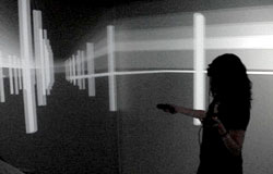
Emma Ross says "I'm not a techie by any means," but she was among the presenters Friday at Duke's annual conference on instructional technology, demonstrating how she used Google Maps, Google Sketchup and other electronic tools to track the journeys of famous 18th century explorers.
A senior from Williamsburg, Va., who will soon graduate with a double major in French and history, Ross was among the presenters at a session highlighting teaching innovations at the Humanities Laboratories of the John Hope Franklin Humanities Institute. She showed maps she created to visualize European exploration of Tahiti.
Ross described how she sifted through the travelogues of Joseph Banks, James Cook and other explorers, creating databases of their interactions with local populations and charting how descriptions of their voyages made their way back to Europe and elsewhere. "Once I had the data categorized, I assigned latitude and longitude points to each entry, based on information given in the travel narratives," she said. The resulting maps made it possible to "recreate the vision of Tahiti that would have been in the minds of 18th century readers of these travelogues."

Ross used Google Sketchup to create models of a British fort and local structures on Tahiti, basing her images on descriptions and measurements she found in the travelogues. Recently she has been creating life-size 3D models of the structures to display inside DIVE, the 6-sided Duke Immersive Virtual Environment at the Pratt School of Engineering. The process has enabled her to "really understand the scale of the colonial experience 'on the ground' and see the spatial relationship of these structures to each other and to the surrounding Tahitian landscape." Her 3D visualizations may be used in future Duke classes.
"I'm not completely finished at this point with either aspect of this digital project, but I'm already seeing interesting ways this data can be used to understand the past and the scale of colonialism," Ross said. "Plotting the physical movements and interactions of the Europeans and Tahitians can show us much of the island the Europeans explored and if there are patterns of movement indicative of a broader set of colonial power dynamics."
Ross said working on original research with history professor Philip Stern and other members of the Humanities Lab was the highlight of her Duke experience, helping her "find my intellectual passion." She participated in the Lab's BorderWork(s) project, which draws on the humanities, social sciences and policy studies to explore how different kinds of borders affect societies. She traveled to London for some of her research.
Ross became "much more interested in technology" through the class, which also got her thinking about attending graduate school. First, though, she's looking forward to spending a year teaching English at a school in France.
