In Flood-Prone Parts of North Carolina, Climate Adaptation Meets the Data Gap
To become more resilient, small towns at risk need better data. Researchers are trying to narrow the gap.
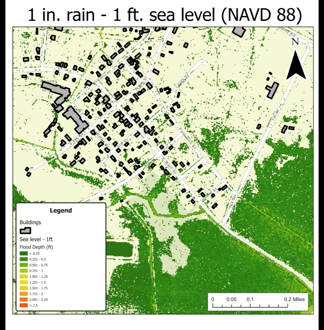
At a poster session in July in Gross Hall, Duke Ph.D. student Aljouhra AlHargan pointed to a simulated map of homes and businesses that could get flooded if a storm dumped more than a foot of rain on the tiny flood-prone town of Creswell, in North Carolina’s Inner Banks.
In the simulation, the river that runs south of town has overflowed and spilled into streets and buildings. Some of the hardest hit areas are under eight-plus feet of water.
“Almost half of the town is flooded,” AlHargan said.
The scenario is more than hypothetical. In August 2011, homes in Creswell were inundated when Hurricane Irene drenched the area in up to 15 inches of rain. The town’s Main Street was indeed underwater for days.
AlHargan was part of a team that spent 10 weeks this summer working with Creswell and the North Carolina Office of Recovery and Resiliency to understand the flood issues some state residents face, as part of the Data+ and Climate+ summer research programs.
And for good reason: Creswell and surrounding Washington County were among nearly 500 communities nationwide identified last year by the Federal Emergency Management Agency as America’s “most at risk" from hazards fueled by climate change.
The communities were chosen based on their vulnerability to a range of natural hazards including floods, extreme temperatures and storms. The FEMA designations also take into account the adverse impacts residents could expect, such as loss of life or livelihood, and how prepared they might be to deal with them and recover on their own.
The idea is to help direct funding that communities like Creswell will desperately need if they are to take on resilience and mitigation projects.
But many small towns and rural areas that want to improve their climate readiness face another challenge: data and capacity gaps.
Communities need information to understand climate risks, evaluate potential solutions and monitor progress. They also need staff time and expertise. But especially for small towns and rural areas, those things can be hard to come by, said Hector Monterroso, a Ph.D. student in the Pratt School of Engineering and the project manager for the team.
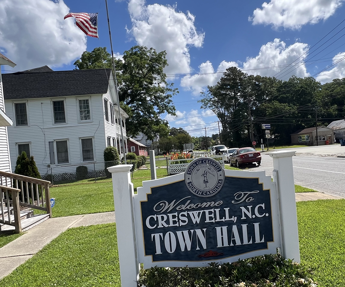
Such is the case for Creswell. This quaint town of 205 residents some two hours east of the Triangle along U.S. 64 is no stranger to flooding.
Though some 40 miles inland, the town’s proximity to the Scuppernong River -- a favorite with paddlers -- means it gets hit hard during rainstorms.
"Our homes and roads are routinely flooded," said Creswell's mayor Alfredia Williams.
The water table is inching up with sea level rise, which means that soils can’t act like a sponge to absorb rainwater as it falls.
More of the rain runs into streams or ditches, where debris and the shallow water table prevent it from draining.
“The city is flat so there's nowhere for the water to flow,” said team member Julia Kagiliery, a Duke environmental science major who graduated last spring, and is starting Duke's Master of Environmental Management program this fall.
As flooding becomes more common in Creswell and other coastal towns, researchers are looking for ways to help residents contend with climate change’s influence on their lives.
The team started by experimenting with different computer models to see if they could find the data needed to run them.
Scientists rely on various kinds of information to understand an area’s level of flood risk, including elevation and topography, landcover, river flow rates and local rainfall patterns. While much of this info is publicly available, that isn’t always the case.
“A lot of data is locked behind paywalls, or not necessarily at a level of detail where it's easy to use,” Monterroso said.
For example, larger cities with bigger budgets like Charlotte provide maps of their storm pipes and drainage systems online, but for smaller towns like Creswell such maps aren’t available. The gap makes it difficult to determine how well equipped the area is to handle rain-related flooding.
To capture the full impact of future deluges, the team needed to consider the capacity of the drainage systems themselves. So the team measured the dimensions of the pipes, ditches and canals that serve as the town’s stormwater system.
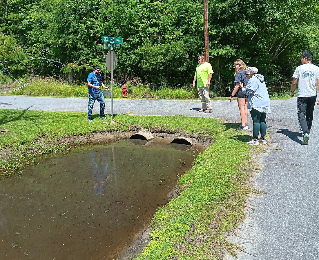
They took those measurements and other data they were able to collect and fed them into a computer program used by the US Army Corps of Engineers to figure out which properties might be at risk when the city’s drainage system is overwhelmed.
Many climate risk models require a steep learning curve, Kagiliery said. But students in Duke’s “Plus” programs aren’t expected to start out knowing everything. Classroom knowledge only takes them so far; they learn by doing and pick up skills as they go.
The team also investigated the total cost of predicted flood damages to the at-risk buildings. In Creswell, where the poverty rate is nearly double that of the rest of the state, initial results suggest that as the water table continues to rise even minor flooding events could exact a huge financial toll, said team member Jun Tan, a rising junior majoring in mathematics and economics.
The team stopped short of suggesting specific strategies to reduce the impact of future floods.
“The goal is ultimately just to arm these communities with ways to collect data that's not otherwise available to them, and how they might build stronger cases to apply for federal funding,” Kagiliery said.
"We are a united community with strong cultural and historical roots," Mayor Williams said. "Together we want to find livable alternatives to the flooding that will strengthen our town."
We’ve still got a long way to go to ensure that North Carolina’s most vulnerable communities have the data they need to protect themselves.
That’s because Creswell isn’t alone. A number of other eastern North Carolina counties made FEMA’s list of most at-risk. This fall, a Bass Connections team is looking at similar issues in other towns across the state.
“Not all communities are going to have the exact same problems,” Monterroso said. “But the first step in decision-making is getting good data. And a lot of these towns don't have that.”
Lydia Olander and Francis Bouchard of the Nicholas Institute led the project, along with Duke civil and environmental engineering professor Mark Borsuk of the Risk Science for Climate Resilience initiative. The team presented their work at the Data+ Final Symposium on July 26.