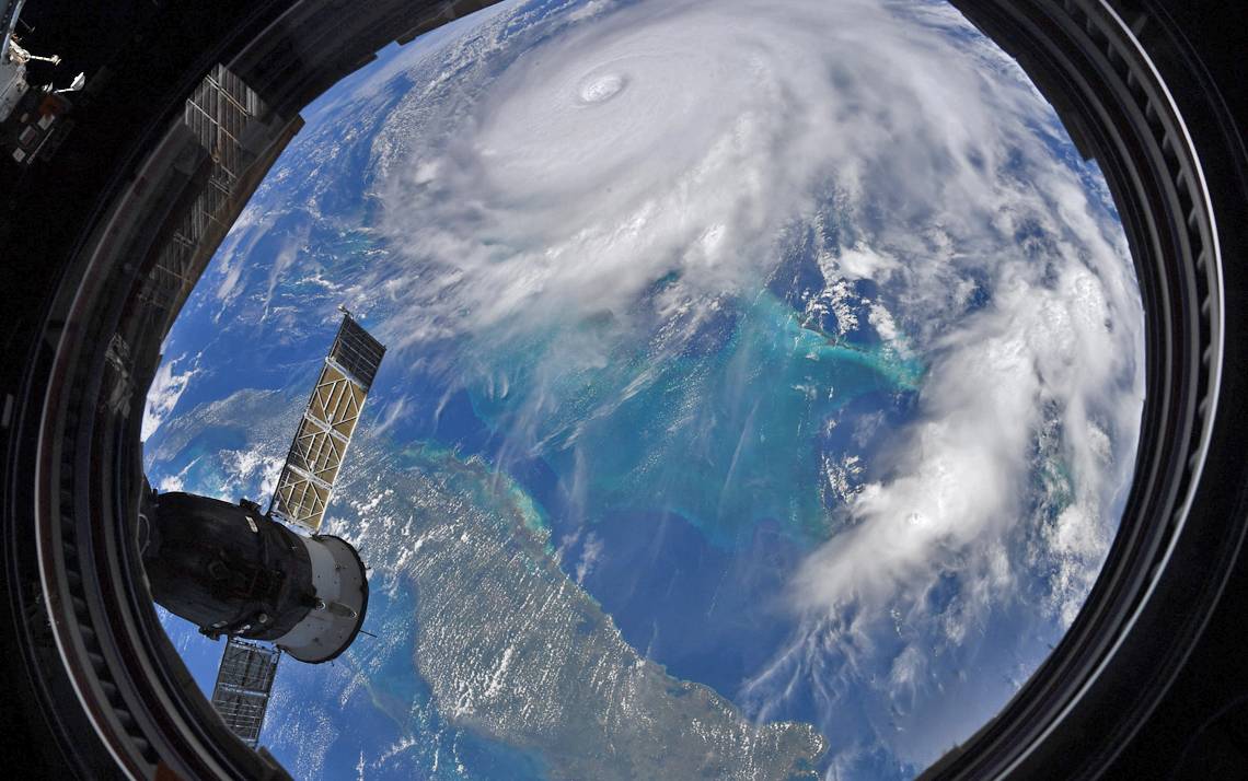
Officials Monitoring Path of Hurricane Dorian
Strongest winds, rain expected Thursday
[Update: Friday, Sept. 6, 2019: 6:45 a.m.]
Early reports indicate that the most damaging aspects of Hurricane Dorian remained east of the Triangle. Through the evening, Duke's main campus experienced steady rain and some wind gusts reaching 30 mph; however, the impacts have not been severe.
Crews on campus and around Duke Hospital report no major issues, and Duke plans to continue normal operations as scheduled.
The rain across the Triangle is projected to end over the next few hours.
[Update: Thursday, Sept. 5, 2019: 11:45 a.m.]
Duke officials continue to monitor the latest projections for Hurricane Dorian. The greatest effects of the storm for central North Carolina is expected between 2 p.m. today and 6 a.m. Friday.
Total rainfall is expected to be between 1 to 1.5 inches in Durham and 1.5 to 3 inches in Wake County. Maximum wind gusts are expected to be 38 mph in Durham and 41mph in Raleigh.
Currently, there are no tornado watches in effect for Durham or Wake counties. Wake County remains under a tropical storm warning and flash flood watch.
Local heavy rainfall may produce flooding in urban and low-lying spots and in areas with poor drainage.
Members of the Duke community are encouraged to use caution while traveling on and around campus during heavy rain or winds and report any potential safety-related issues, such as downed trees or power lines, immediately to Duke Police at 919-684-2444. Gusty winds could knock down tree branches and produce isolated power outages. Outdoor furniture and other loose items should be secured or moved indoors as a precaution.
For any power outages at Duke facilities or off campus, please call Duke Facilities Management customer service 919-684-2122 or send email to fmd-report-power-out@duke.edu. Please include the physical address of the building.
At this time, Duke transit buses are operating on a regular schedule but check Duke TransLoc for real-time updates.
Due to weather conditions, two women's soccer games scheduled for today on campus will be played earlier.
Duke does not expect to active the severe weather and emergency conditions policy for the main campus, but community members should review the guidelines for what to do during a hurricane on the DukeALERT website.
Follow Working@Duke on Twitter for updates.
[Update: Wednesday, Sept. 4, 2019: 2:45 p.m.]
A Tropical Storm Warning has been issued for Wake County until further notice.
A Tropical Storm Warning means tropical storm-force winds are expected somewhere within this area within the next 36 hours. The current forecast for Wake County includes sustained winds of 20-30 mph with potential gusts up to 40 mph.
Hurricane Dorian is expected to remain a Category 2 storm as it moves up the North Carolina coast.
The storm's arrival has been slightly pushed back with forecasts suggesting it will move over or just west of Cape Lookout at 8 a.m. Friday.
Follow Working@Duke on Twitter for updates.
[Update: Wednesday, Sept. 4, 2019, 8:15 a.m.]
There has been very little change in the track of Hurricane Dorian, but the overall timing through central North Carolina has slowed down. The strongest storm impacts will likely be Thursday through mid-day Friday.
Tropical-storm-strength wind gusts are not expected for most of the Triangle area. Maximum wind gust for Durham are expected to be around 27 mph and 33 in Raleigh. However, wind gust could still blow over trees and cause power outages. For any power outages at Duke facilities or off campus locations, please call Duke Facilities Management customer service at 919-684-2122 or send an email to fmd-report-power-out@duke.edu. Please include the physical address of the building.
From Raleigh westward, rainfall amounts will remain around 2 inches or less. Durham and Wake counties are not currently under any storm watches or warnings.
Follow Working@Duke on Twitter for updates.
[Update: Tuesday, Sept. 3, 2019: 10:25 a.m.]
Effects from Hurricane Dorian are expected to impact central North Carolina from late Wednesday into Friday morning. According to the National Weather Service, specific impacts remain uncertain at this time, however, heavy rainfall and strong gusty winds are more likely in areas along and east of Highway 1.
Along the coast of North Carolina, conditions are projected to be considerably worse as the storm is expected to be a category 2 hurricane as it approaches. As a result, Duke officials have decided to cancel classes at the Marine Lab in Beaufort, N.C., Wednesday through Friday and relocate undergraduate students to Durham on Wednesday morning.
While current projections indicate less than 3 inches of rain for central North Carolina, isolated flooding could be a factor in low-lying areas. Winds should be well below tropical storm force in central North Carolina, but outdoor furniture and other loose items should be secured or moved by late Wednesday as a precaution. For any power outages at Duke facilities or off campus locations, please call Duke Facilities Management customer service at 919-684-2122 or send an email to fmd-report-power-out@duke.edu. Please include the physical address of the building.
Duke does not expect to active the severe weather and emergency conditions policy, but community members should review the guidelines for what to do during a hurricane on the DukeALERT website.
Updates will be posted on this website as more information becomes available.
[Original Post]
Duke officials are closely monitoring the progress of Hurricane Dorian, which is projected to reach the Carolina coast late Wednesday with the strongest winds and rain on Thursday.
The hurricane is expected to weaken from to a Category 2 storm by the time it reaches the Carolinas. The National Weather Service estimates that tropical storm force wind gusts in the Triangle area could begin Wednesday evening. Central North Carolina could also receive between 2 and 6 inches of rain Thursday into Friday morning.
The heavy rains and winds will increase the potential for downed trees and power lines. Kyle Cavanaugh, Duke's emergency coordinator and vice president for administration, said that the Emergency Management Team is already in close contact with officials from the Duke Marine Lab, located on Pivers Island in Beaufort, N.C.
"A decision regarding cancellation of classes and evacuation of undergraduate students will be made Tuesday morning after assessing the latest models for the storm," he said.
Officials will continue to monitor the storm and provide updates as necessary.